
Active weather-Icy AM mix to rain & fog
Active weather-Icy AM mix to rain & fog
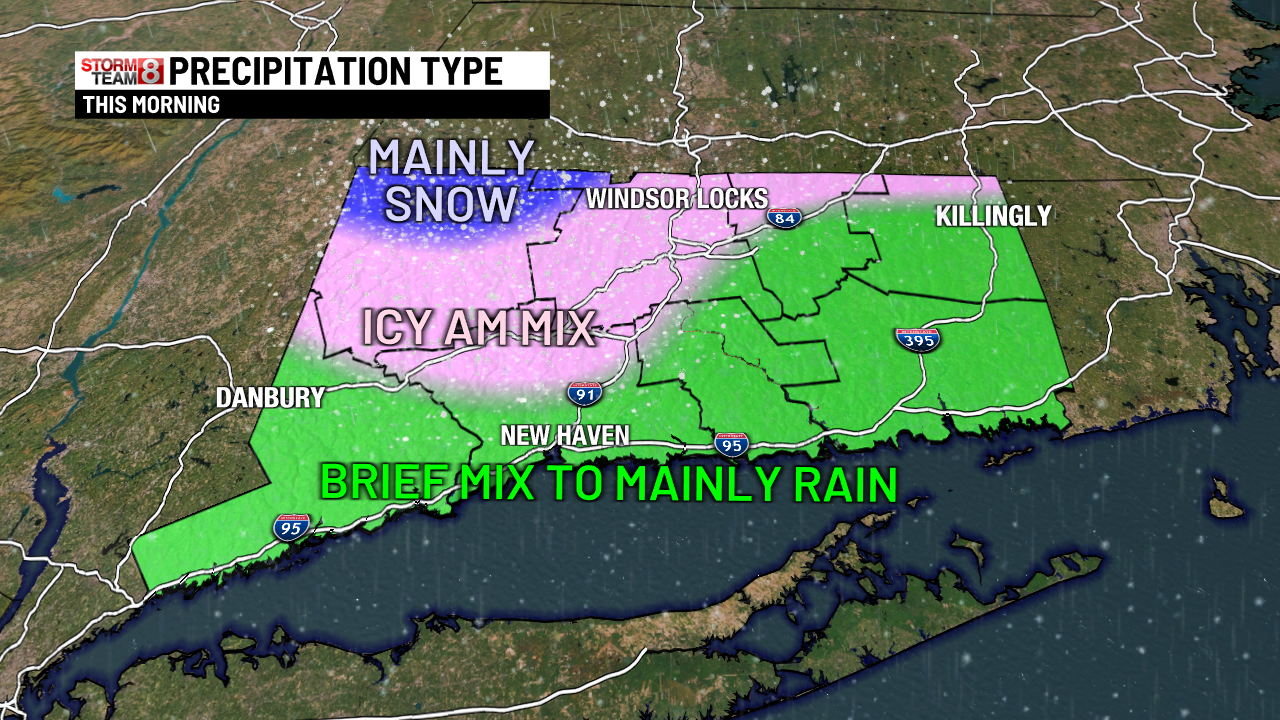
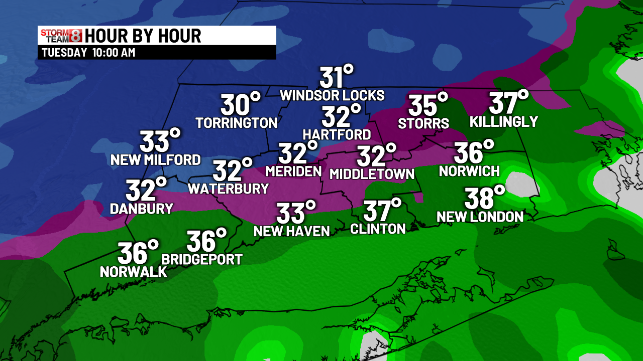
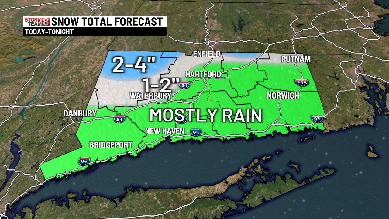
Some nasty weather developing this morning with an icy mix for a couple to few hours. Much of what falls will be rain for the southern half & much of the eastern half of the state. A wintry mix is expected for northern Connecticut, with the highest impact of snow & icy mix for the Northwestern part of Connecticut, where 2″ to 4″ of snow & ice could accumulate. A brief change back to snow & a mix is possible as the storm pulls away tonight. Caution for icy surfaces everywhere for the Wednesday morning commute as temperatures fall below freezing right down to the shoreline. A cold pattern late week and a weak system to watch for this weekend.

Early this morning: Cloudy & cold with lows 22-28. A spotty light snow shower or a spotty mix possible in a few towns.
Today: Any mix quickly changing to rain for southern Connecticut. Icy mix inland for a while with slick surfaces possible, then changing to rain around noon. Mostly snow/ice in NW CT with 2″ to 4″ there. Timing looks to be mostly 9 AM-9 PM.
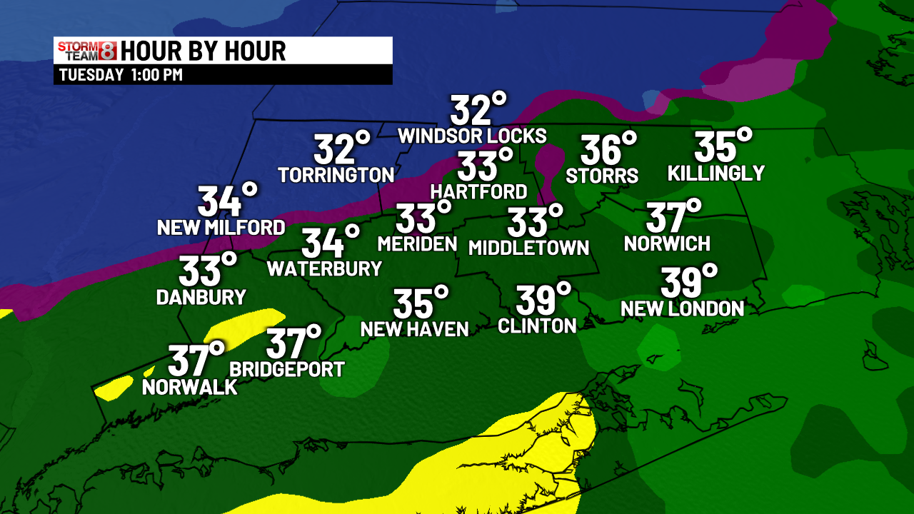
Tonight: Rain ending as a mix or snow showers. Snow & ice ending in NW Connecticut. Wet surfaces freezing up from north to south. Be careful! Windy with lows 23-32.
Tomorrow: Icy surfaces to start as wetness freezes up. Mostly sunny & brisk with highs near 40.
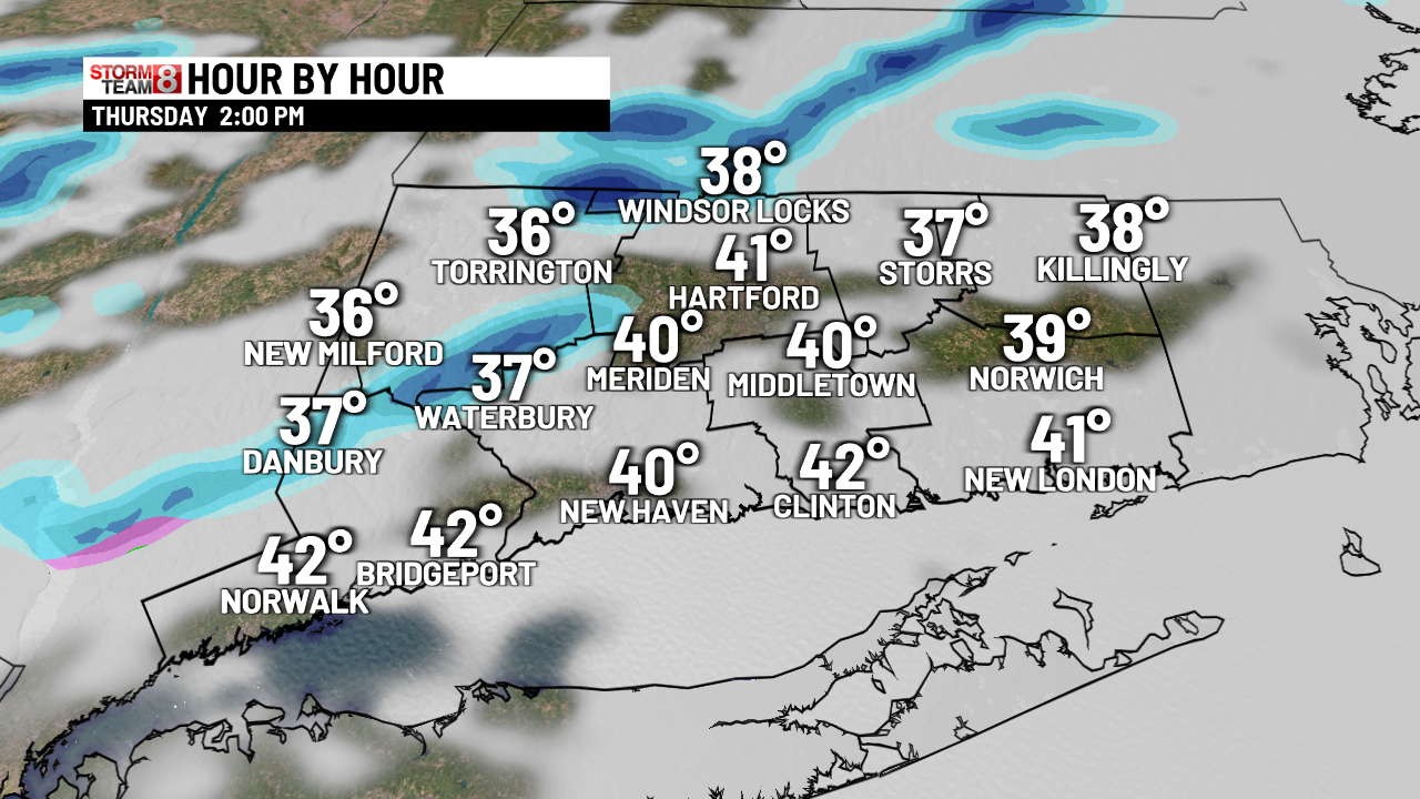
Thursday: Partly sunny & becoming windy with afternoon flurries or passing snow squalls. Highs in the 30s to lower 40s then falling fast.
Friday: Starting in the teens! Mostly sunny and cold all day. Highs in the 20s to lower 30s.
Saturday: Cloudy with a rain or snow shower. Highs in the upper 30s.
Sunday: Partly sunny. Highs near 40.
Monday: Mostly sunny and cold. Highs 30-35.
Tuesday: Increasing clouds & cold. Highs in the upper 20s to lower 30s.
2025-12-02 09:37:00